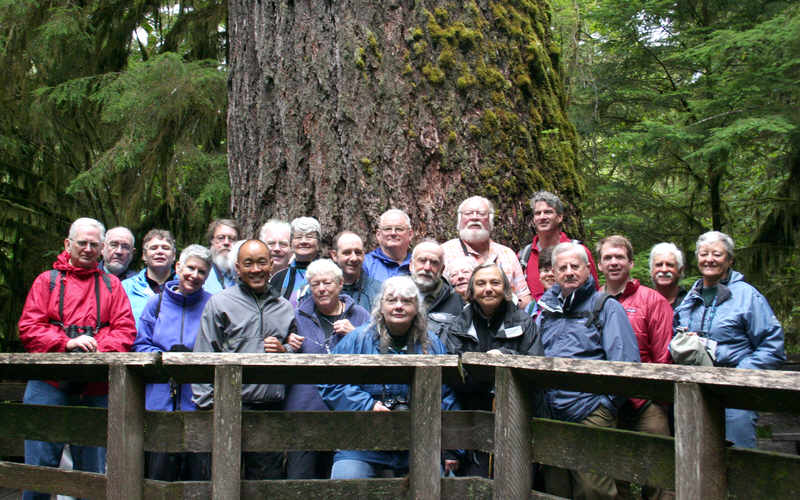
The fearless adventurers
---
The still fearless adventurers
There is also a SECOND PAGE of pictures now. Click on "second page" to open that in a new window.
The photos are not well organized yet, nor much text written. Having had a molar tooth out, and trying to do what I ought to be doing at the moment keeps getting in the way of "playing" with this!!
If you have pictures you'd be willing to contribute to this page, please click here for a message about that.
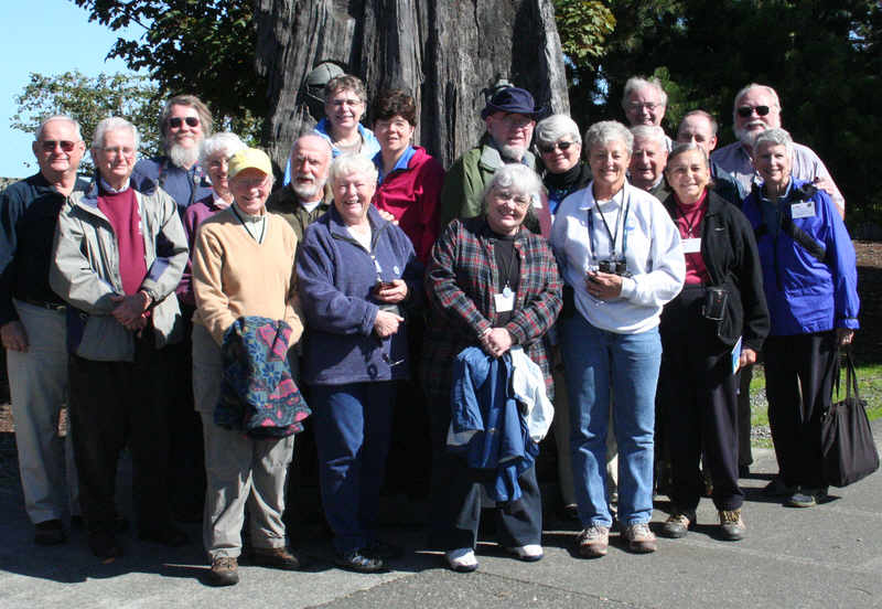
The fearless adventurers
---
The still fearless adventurers
---
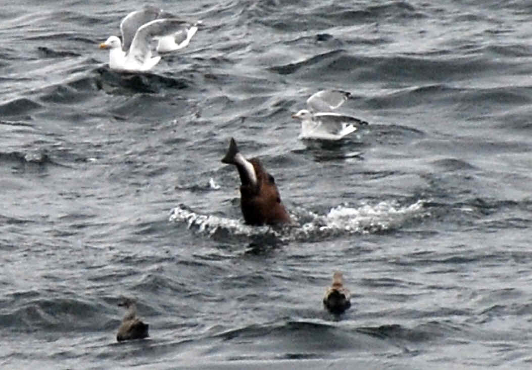
Courtesy of Gene Helfman
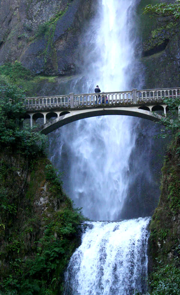
Multnomah Falls
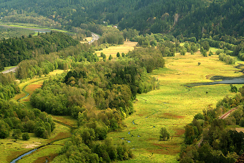
View from Crown Point, Oregon
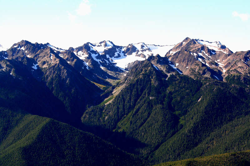
View from Hurricaine Ridge
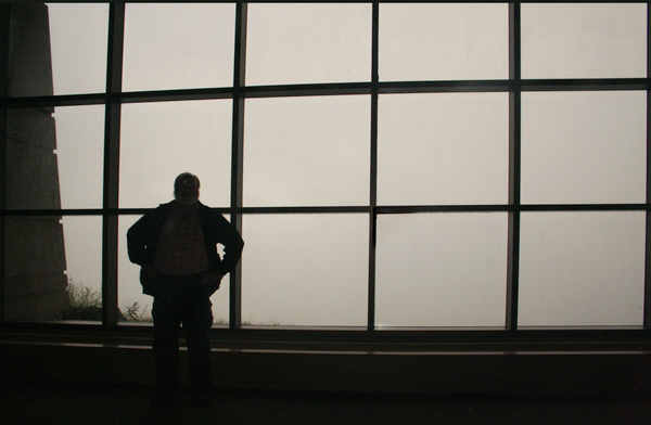
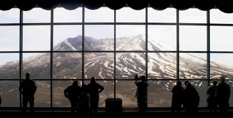 Of course things don't always go according to plan. With thanks to WoodleyWonderworks at Flickr, you can see at the left what some people see at Mount St Helen's....
... and below, you see what we saw!
No prizes for identifying the person in the foreground. He may have an effect on the weather around volcanoes... I saw one in Costa Rica with him too... and it looked the same.
Speaking of volcanos.... Kirsten Potter's fascinating book, The Wave: In pursuit of rogues... (think Simon Winchester's Kracatoa or Richard Preston's Big Trees, but about ocean waves and surfing) sent me off to maps.google.com to look at the island of La Palma in the Canaries. (Not named for the bird, by the way, did you know?) That link should open a new tab or window with the island shown in map/ terrain view. If you don't get that, tweak it. ("Terrain" is under "other").
What do you see? It took me a while to get my eyes "tuned", but yes that is a narrowing basin going to the SW from the center of the peak, and a (smaller) ridge going to the SSE. Etc. How do you interpret what you see? Do you know of any good website setting out the "official" view?? (If so, please send me the URL!!). (I've put my ideas further down the page.)
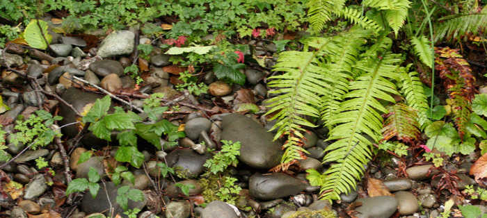
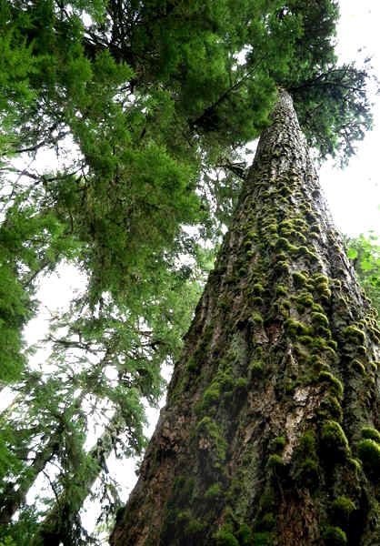
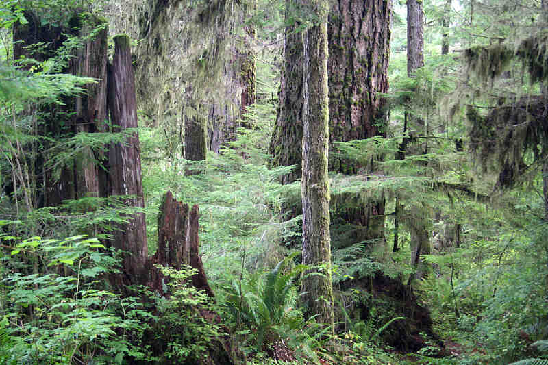
But however shy the volcano may have been, the trees we were shown were magnificent....
---
. . .
---
---
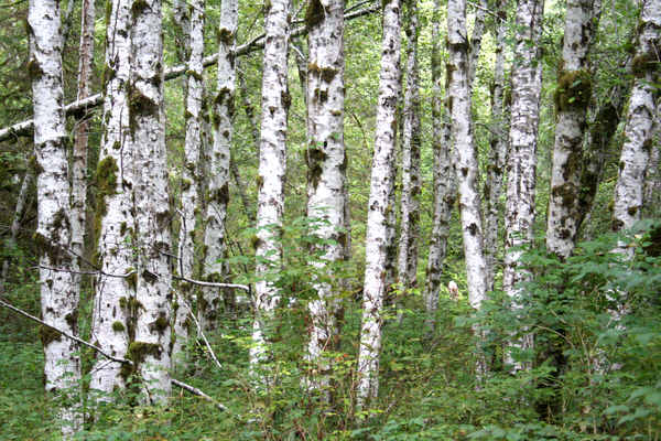
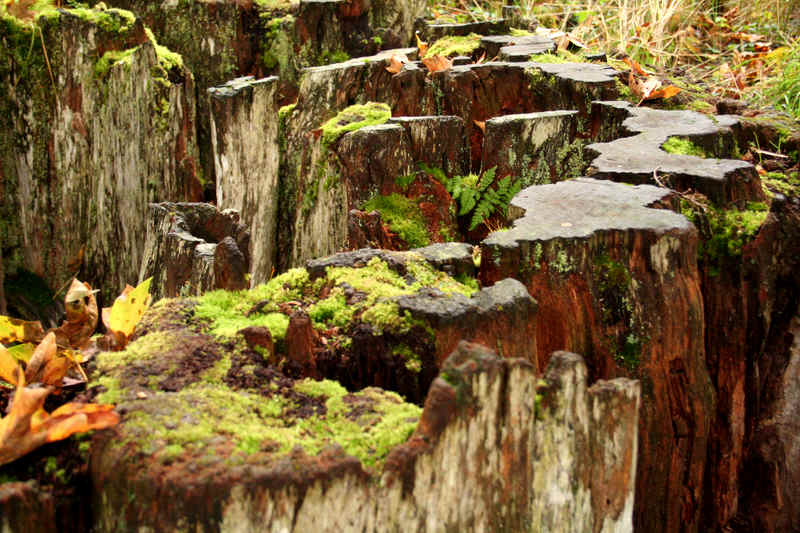
Alders... early colonizers, and nitrogen fixers.
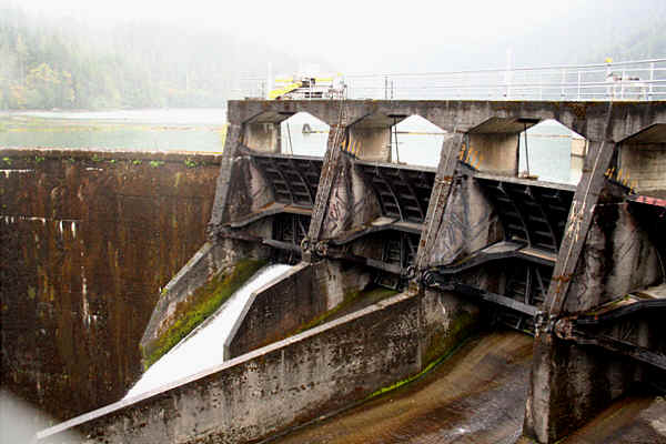
Upper Elwha dam... to be removed soon.
---
My ideas on La Palma....
I think we started with a simple cone, circular island. Then a HUMONGOUS event blew out the southern side, and that triangle of land to the south of the cone (and it's remains) was the result. You can see "scars" of the blow-out at "4 o'clock" and "7 o'clock"
Subsequently, another cone build, a little south of the current "main" cone... and then blew away, straight up, or to the west. This is my explanation for the small ridge marked "Brena Alta", to the east of El Paso. (A long way east of the other El Paso!)
THEN the (today) main cone (re)built itself, but of fairly light ash, not solid basalt. And there was a weakness, or another minor "blow out", this time at the SW lip of the caldera, and rain (or lave alow?) has eroded out dramatic "tear drop shaped" basin, with the "top" of the "drop" to the SW of the top of where the cone would be, had it not eroded.
Even if only half right... what an amazing story?!
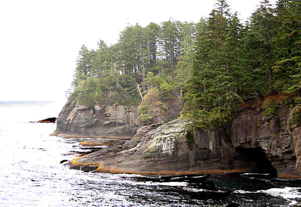
Cape Flattery
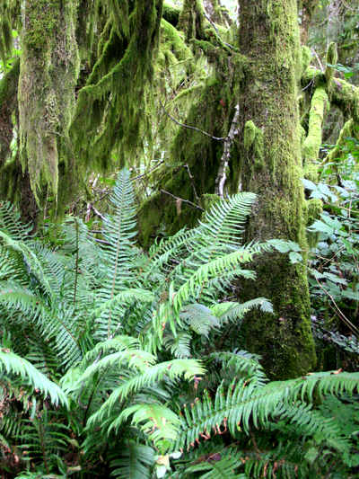
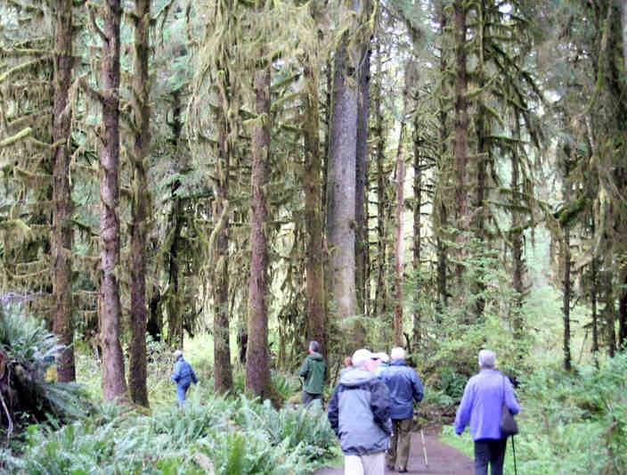
Hoh River woods
---
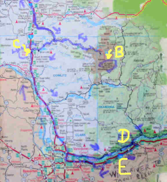
OVERVIEW map....
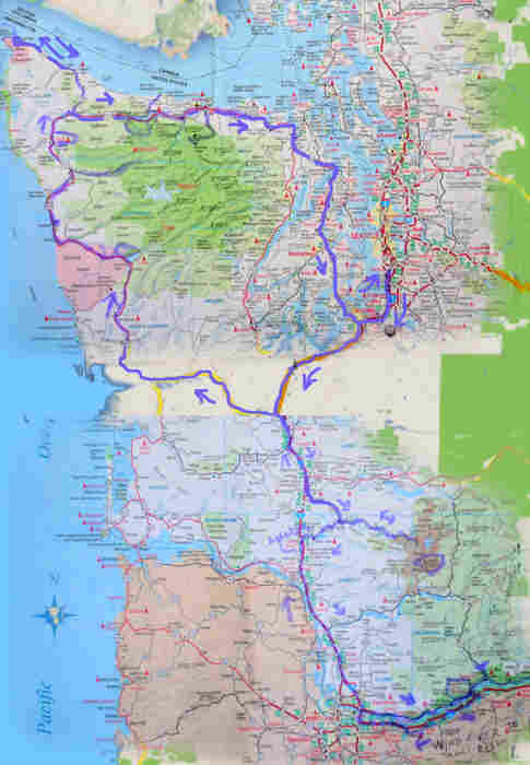
Top portion of trip...
A: Start, Seattle; F/I: Kalaloch Lodge; G:Lake Quinalt Lodge; H: Hoh river Valley; J: Neah Bay and Cape Flattery; K/M:Lake Crescent Lodge; L:Elwha River and dams; N:Hurricaine Ridge; O: Port Angles; P:Tacoma Narrows Bridge; Q: Seattle
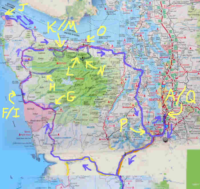
Bottom portion of trip... B: Mount St Helens; C: Lunch at Hatties in Castle Rock; D: Bonneville Hot Springs Resort; E: Multnomah Falls
For video of Tacoma Bridge oscillation and collapse, go to http://www.youtube.com/watch?v=j-zczJXSxnw. Have your sound on. View is towards the west. Amazing that the poles with the overhead lighting didn't snap off, and that the asphalt didn't crack and peel, don't you think?? If you search with Google for "Tacoma Narrows bridge disaster video" you can turn up no end of interesting stuff. Sad detail: There was a dog in the car that went down with the bridge. People tried to rescue him, but he was crazy with fear, and could not be dragged clear. Or so it says on the internet....
© TK Boyd 09/10. Click here to contact him.
(Participants: Use eddress on CAU list, please- better!)
You are also invited to Tom Boyd's homepage, including software for schools, kids, and others.
If you want more travel pictures, start at those I took in Istanbul and Athens in 2009, as a consolation to help me endure the fact that not enough people signed up for the CAU trip to Tanzania. From there, you can go to other trip albums, many of them made possible by CAU.
Don't forget the SECOND PAGE of pictures. Click on "second page" to open that in a new window.
(Hmmm.... while tidying that, I was amused to note that I have no photos online of Berlin... which I have visited "many" times... once while the Cold War was well frozen... machine guns at Checkpoint Charlie, etc, once during the fall of The Wall, once for the tenth anniversary of the Wall's fall... and one "extra" time! Do I think Berlin is a good tourist destination? I'll let you guess.)
- - - Page ends - - -