This is a subsidiary page. My Morocco pictures site has a main page which gives you the links you need for more.
Where is most life on earth? By almost any measure?
As you read this introductory material, keep in mind that the page is called "Geology in Morocco".
Answer to the trick question: Add one to each letter in the following. ("z" becomes "a"). In other words, in my "let you think about your answer first" code, "cat" would be written "bzs". Answer to the trick question: In the nbdzmr.
That's a "trick", because I imagine many people answered "the Amazon". "The oceans" is such a broad category, that even the vibrant Amazon can't compete.
Am I rambling??? ("Again", you say?) What do the oceans have to do with Morocco's geology? Bear with me!
What happens to things in the ocean when they die? They sink to the bottom, don't they?
And over millions and millions of years, that "dust", on the "floor" builds up into thick layers. And, besides the "rain" of dead things, near the continents, dirt carried by rivers is dumped in the oceans, and eventually accumulates in the depths.
And then the "magic bit" happens. As the Bible says, "every valley shall be exalted"... which some of the (wretched) modern "translations" render as "every valley shall be lifted up". (See, I'm not too proud to quote the enemy if it suits my purpose. But I do it with gritted teeth. Oh. Now I AM rambling, maybe. (The other day, I handled a second impression of the King James Bible. Thrilling. If you feel up to being responsible for it, I can tell you where it is for sale. There are (at least) two misprints in it: "She" for "He"... in reference to God, and "Judas" for "Jesus". Oops.) Back to geology....)
At the "stuff" accumulated on the sea floor, the lower layers were compressed by the overlaying upper layers. If you are under, say, 500 feet (or more) of "stuff", you will find the pressure more than inconvenient. Eventually what started as sloppy mud gets squeezed into rock, or at least very dense clay.
What was ocean floor... created by the accumulation of lots and lots of "stuff".... is, today, dry land. In some places, vast portions of the sea bed were pushed straight up, undisturbed. In others, the seabed was pushed up unevenly, being tilted and or folded, bent, twisted.... and you can see this again and again when you drive in the interior of Morocco. (There are also areas, I think, where ash from ancient volcanos are part of the story.)
Two last details, and a warning, before I give you some pictures: When the "stuff" rained down on the sea bed, conditions were not always constant. The resulting rock is sometimes quite soft, sometimes quite hard. Sometimes the rock of an era's layer "cuts" quite easily when water runs over it. And sometimes it does not.
After the sea bed was lifted up, above sea level, the stuff- now- soil- and- rock is exposed to the rain. And, in an example of chaotic behaviour, there will be one place that is just a little weaker, a little softer, and the water, running back to the sea, will begin to make a tiny gully there. And then the next water will be carried to the gully by gravity, and so that bit of the former ocean bed will be subjected to more erosion than some adjacent areas. If everything were homogenous, that would be that. But everything is not homogenous. In due course, the gully cuts down to a place where the rock is harder, and now the greater hardness may out weigh the greater flow of water... and new gullys will begin. At the very least, the exisiting gully will widen more quickly than it has been widening, as the harder rock resists the erosion.
That's the details done. Now the warning: I fear the pictures don't always show things as clearly as I would wish... but I hope that you will find that they repay a bit of study and reflection...
Just driving around in Morocco is an education in geology. This page has been set up to display photos which try to illustrate what I mean by that. Of course, the geology of Morocco will also show up in photos on other pages.
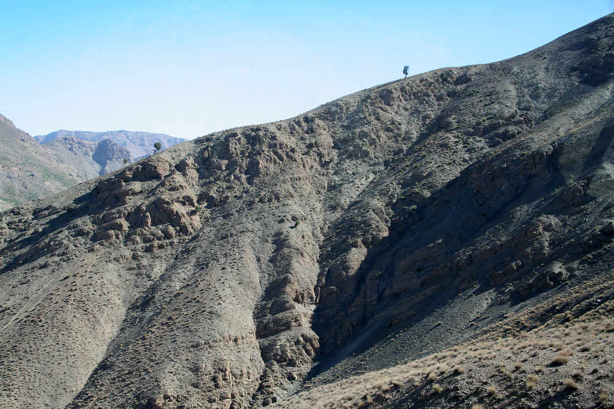
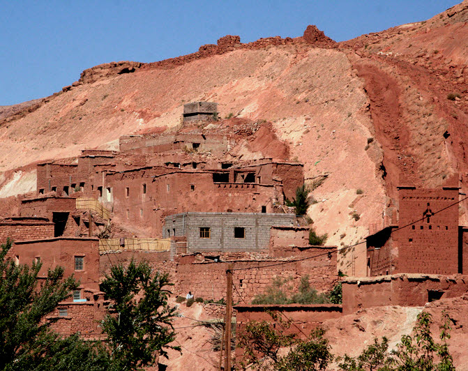
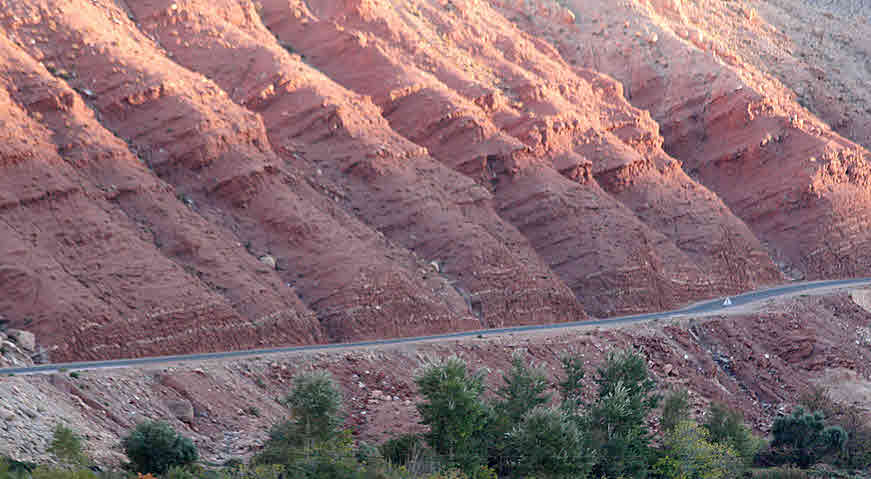
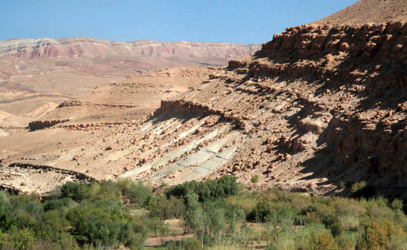
(Left hand image): Why now? That hill has been around for a while. Why is erosion bringing it down now?
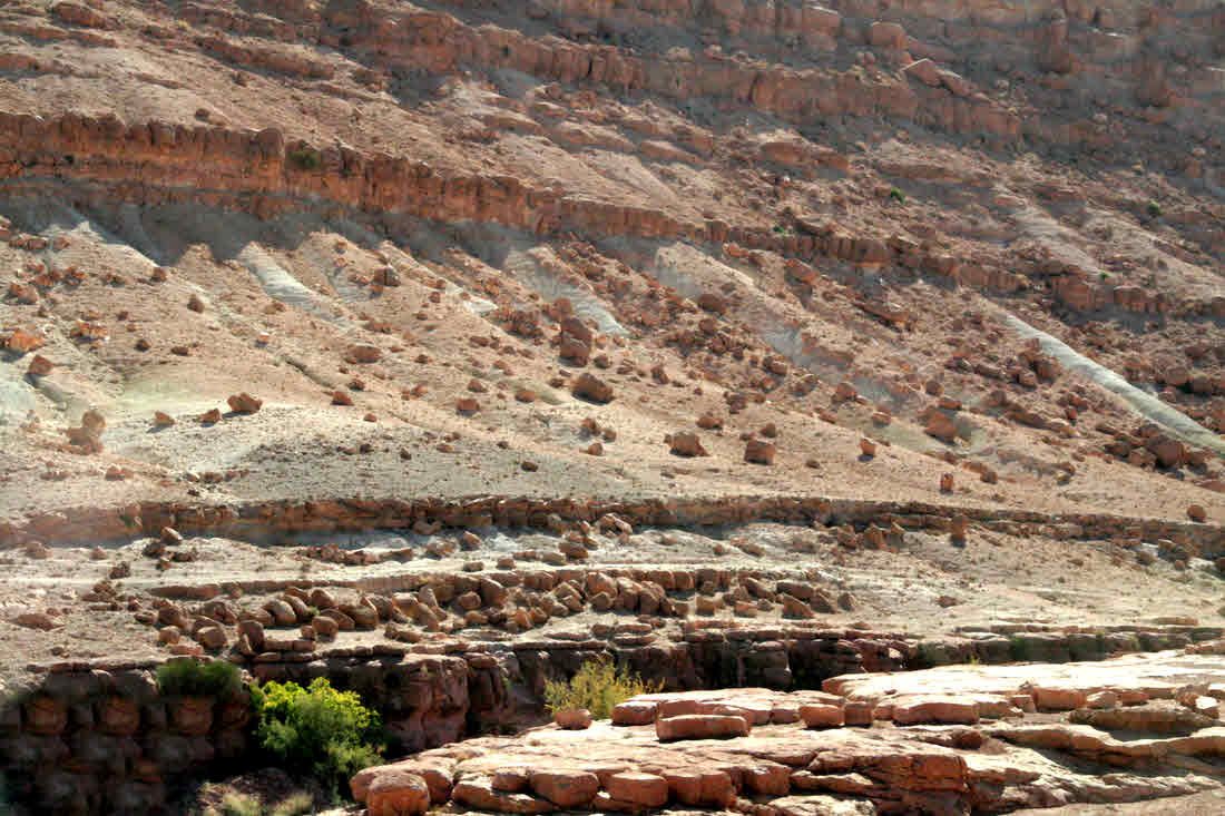
(Right hand image): Twist and shake! The bushes are about 2' across, to give you the scale. Here we see relatively small blocks... "only" about "house" sized, tipped varying amounts... the main one seems to have been tipped nearly 90 degrees.
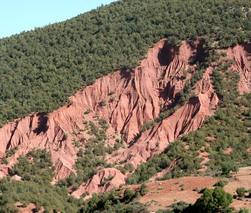
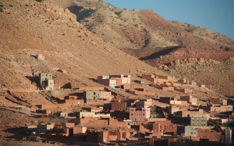
(Left hand image): A typical village: Near the water, but, as a result, below the slopes which are gradually falling into the valley bottom.
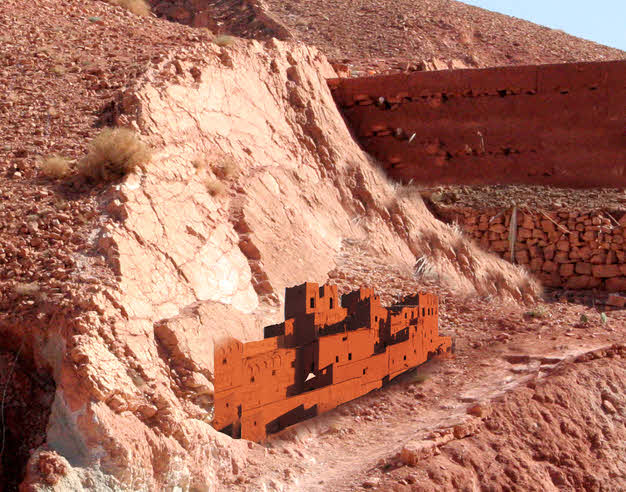
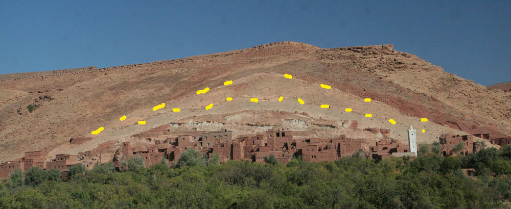
(Right hand image): A remarkable village site, only one of its kind I saw. And I utterly failed to photograph properly what was going on. Start with an area where the tipping of the layers was about 50 degrees. And in them, there was one particularly durable one. Over the millenia, the softer overlying rock had been worn away, leaving the robust layer as the sloping "top" of the ground. Below that embankment, a village could exist with relatively little peril of falling rocks. (I've artificially lightened the surface of the hard layer, to help you to see it. The photo only shows part of the village, but all of it had similar protection.
(Left hand image): Laugh if you like... I'm smiling with you... up to a point. But this fake created with photo manipulation software gives you an idea of the scale of the "protected by tilted slab of good rock" village. In fact, the slab was even larger, relative to the village.
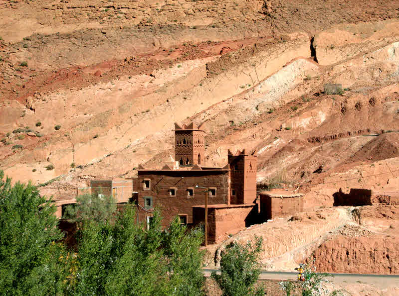
(Right hand image): Another small part of the same village.
One last (for now, anyway!) picture of the town below the protecting slab. The yellow dots were added to the image by me, to show you the edges of the main protecting slab, and slightly larger one behind it.
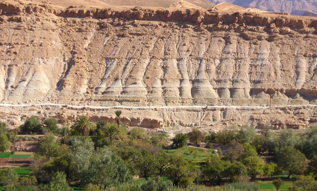
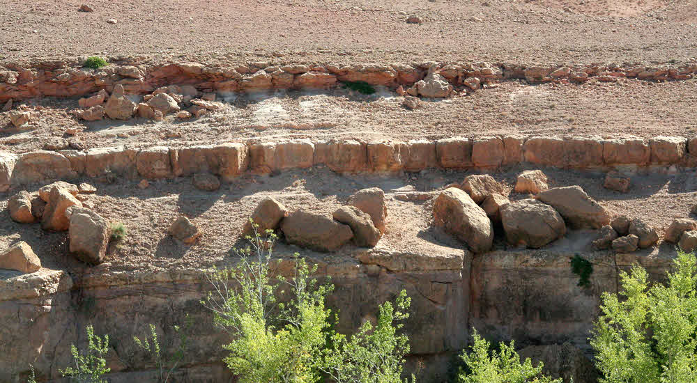
Do you see, below, how some layers erode more quickly than others? That will be due to differences in the hardness of rock/ soil from layer to layer. Think about it... when that differential erosion has gone on too long, there will be an unsupported bit of hard rock, with soil and rock above it, and it will snap off. (This image is also another illustration of the fact that the once horizontal layers do not always stay horizontal.)
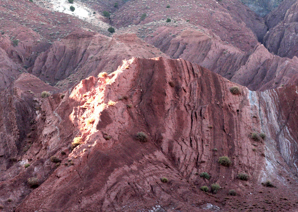
If the layers haven't tilted much, and the "strong" layers are quite thick, then when the "weak" layers get eroded away, the strong layers break up into big... sometimes huge... blocks. (The ones on the left are not small, but the ones on the left averaged about 10' on a side.)
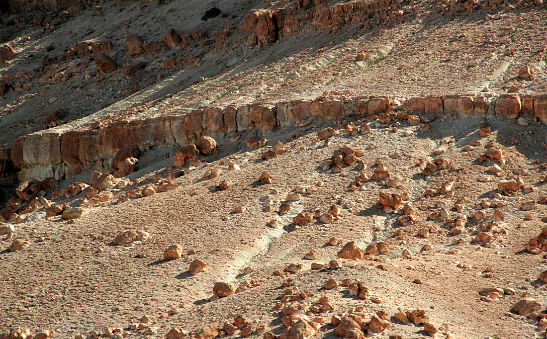
Also huge... some in the right hand picture the size of small houses, if memory serves. You notice: No village built below these hillsides!
(Please remind me I said that, if this is still here 5 December 2013... subject line "Page morocco2013/geology.htm")
This page © TK Boyd 5/12. Click here to contact him.
You are also invited to Tom Boyd's homepage, including Windows software for schools, kids, and others.
![]() Page WILL BE tested for compliance with INDUSTRY (not MS-only) standards, using the free, publicly accessible validator at validator.w3.org. Mostly passes. There were two "unknown attributes" in Google+ button code. Sigh.
Page WILL BE tested for compliance with INDUSTRY (not MS-only) standards, using the free, publicly accessible validator at validator.w3.org. Mostly passes. There were two "unknown attributes" in Google+ button code. Sigh.
- - - Page ends - - -