© TK Boyd 2/11
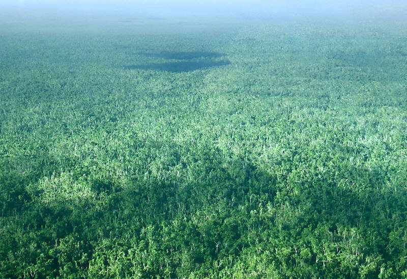
The Belize rainforest from the air... and there were miles and miles like this. Care to propose a way to estimate the number of trees?
This is a sub-page of a collection of photos. There is an index to these pages about our Belize adventure with CAU.
From Chan Chich, we spent a fun day moving on to our next "main event", with some valuable "extras" along the way. We flew to near Xunantunich, an excavated Maya site, (see Wikipedia article for more information), had an excellent guided tour, then lunch in a local open air restaurant with (prosperous) locals, then drove through stunning scenery to the coast. It was a day of seeing a bit of the everyday people of Belize, as opposed to our delightfully isolated experiences in the rainforest and the island paradise.
© TK Boyd 2/11
The Belize rainforest from the air... and there were miles and miles like this. Care to propose a way to estimate the number of trees?
© TK Boyd 2/11
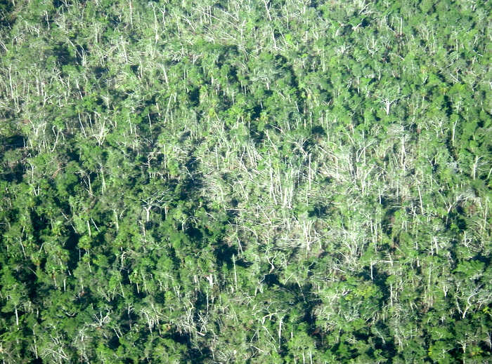
Effect of hurricane on rainforest. Try not to imagine the fires to come, with all that dead stuff. Sadly, there just isn't the funding to do all of the possible studies on the hyperactive adjustment of the ecosystem which is occurring at the moment.
I'd like to thank the excellent pilots and ground personnel of Tropic Air who whisked us from remote place to remote place with professionalism. I wish the planes I flew were maintained like their Caravans, and that I could do such good short-field landings. (Take a look at the landing places we went, using the Google Map of our journey... but don't let it shake your resolve to go where we went!)
See Wikipedia article for more information.
© TK Boyd 2/11
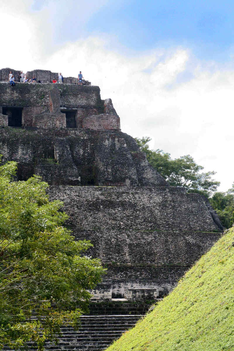
Below, I have for you a 360° panorama from the top of the main pyramid, 130' high above plaza, itself on a hilltop. (With thanks to Serif.com for their free "lite" version of PanoramaPlus which did a good job of this, with no hassle for me.)

© TK Boyd 2/11
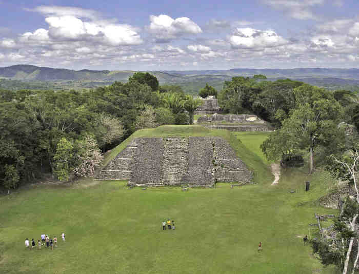
The pale bit, just left of center, is the rest of the site, which was north of me as I took the panorama. To the east, not very far, is Guatemala. And everywhere else: Jungle! Which was the point of this... to show you something you won't often see in more developed areas.
When you are there, guides can point out other, mostly unexcavated, Mayan sites within sight of Xunantunich, but in this wide angle view they are hard to see.
(Perhaps in the interest of accuracy, I should mention that I did a little photo manipulation to "clean up" the bottom edge. Nothing to distort the experience you would have at the site.)
And here is a better view, to the north again, magnified....
© Wm Ferry 2/11
Next we have an experiment... don't waste a lot of time playing with it if it doesn't "just work"... but you may find a scrollable Xunantunich panorama. You should find that by putting your mouse pointer on the image, and dragging (or using the "arrow keys"), you can "look around". If you've got one, if you click on the "-" a few times, you get the full height displayed. Sorry about the resolution... I hope it is fun, anyway. Please let me know whether you like this, or that it was trouble, on your machine. Will it play on iPads? Works better on Firefox than on Internet Explorer... the latter doesn't let you "pull back", and see the whole height... not IE 8, anyway.
To understand the scale of the site, note the person on the path (near-white), just to the right of the pyramid, which is not the largest on the site... I was on that, while taking the pictures!
And now early efforts with a new program.... This should reward a bit of "playing about" with your mouse over the image... including right-clicking.
Don't forget: There are other pages with more information. And at 25Mar11, this collection of photos is still evolving.
This page © TK Boyd 2/11. Click here to contact him.
(Participants: Use eddress on CAU list, please- better!)
You are also invited to Tom Boyd's homepage, including software for schools, kids, and others.
![]() Page tested for compliance with INDUSTRY (not MS-only) standards, using the free, publicly accessible validator at validator.w3.org. An early draft of the page was valid apart from several things inside the code to embed the video clip of the ocelots.
Page tested for compliance with INDUSTRY (not MS-only) standards, using the free, publicly accessible validator at validator.w3.org. An early draft of the page was valid apart from several things inside the code to embed the video clip of the ocelots.
- - - Page ends - - -